Stormy Pattern Continues This Week with More Rain, Mountain Snow Ahead for California

news image
Top Stories
18 Feb 2026 11:40 AM

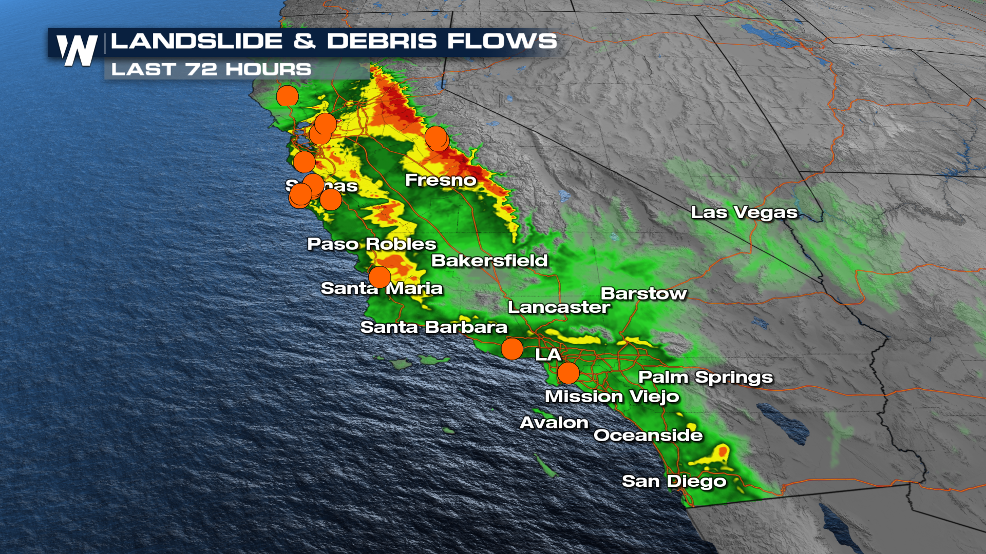
CALIFORNIA - The state of California has been impacted by the first of several frontal boundaries that prompted severe warnings, flash flood warnings, heavy mountain snow, and gusty winds Tuesday into Wednesday morning. The next in a series of fronts moves onshore over the next day or so, adding more to all the previous totals.

An active weather pattern will stick around for much of the week, bringing periods of rain, mountain snow, and cool temperatures across the region. While today will not be a total washout, expect scattered showers at times, especially along the Central Coast, as the bulk of the overnight storm system moves out by sunrise.

Timing

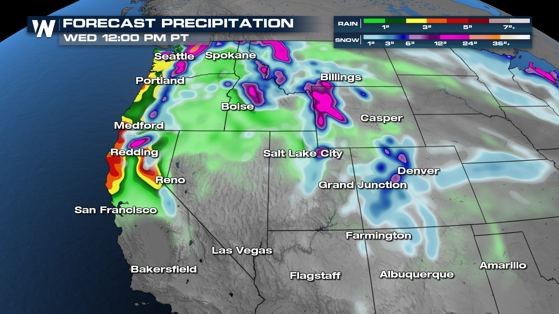
Another system arrives overnight Wednesday into Thursday, delivering another round of rain and mountain snow before tapering off late Thursday afternoon and evening. Several inches of additional snow are expected in the mountains, particularly above 5,000 feet. Snow levels could drop to around 4,000 feet Thursday morning and again Thursday night into early Friday, which means portions of Interstate 5, especially near the Grapevine, could see accumulating snow and lingering slick conditions into Friday morning. Check for road closures and delays as heavy snow will be very impactful across the higher elevations and passes.

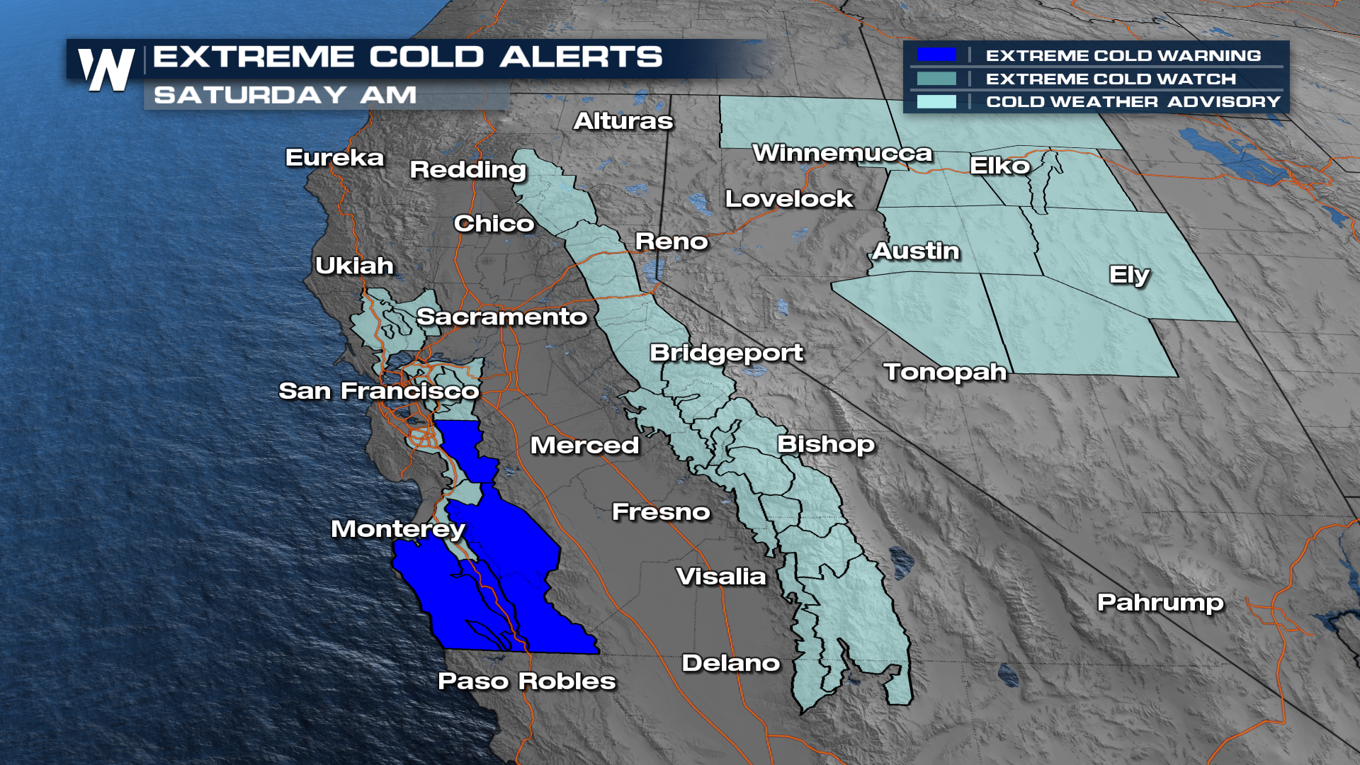
Rainfall totals with this next system are expected to range from about a quarter to a half inch across the coast and valleys, with up to an inch possible in the mountains. Areas north of Point Conception may see slightly higher totals due to persistent northwest flow keeping showers around longer. Behind the storm, Friday looks dry but chilly. Depending on how quickly skies clear and winds calm overnight, some valleys could experience patchy frost or even freeze conditions early Friday morning.

Winter weather alerts have been issued for much of California through Wednesday.

  • 2000-2500 feet: up to one foot

  • 2500-3500 feet: one to two feet

  • 3500 feet and above: four to eight feet

  • wind gusts up to 45-55 mph

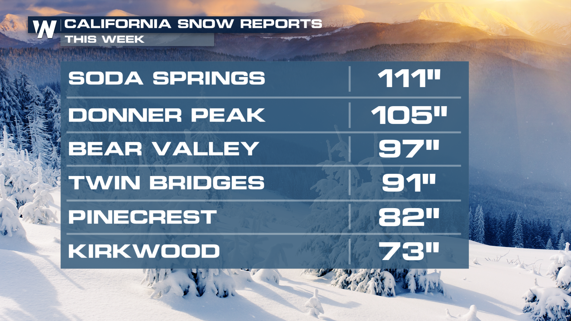
Travel could be impossible in some spots with the high snowfall rates and winds. Snowfall totals could surpass 4-5 feet in some areas, like Mammoth Mountain. Resorts around Lake Tahoe could also see 4-5 feet, including I-80 and the Donner Pass. The heavy snowfall rates will make mountain travel impossible at times.

Even the mountains in Southern California will see heavy snowfall developing this afternoon and evening. Travel will be very difficult at times through early Thursday.

The weekend brings some improvement. Saturday is shaping up to be the nicest day of the next seven as a weak ridge builds overhead. Expect mostly sunny skies, dry conditions, and a modest warm-up with highs climbing into the 60s. 

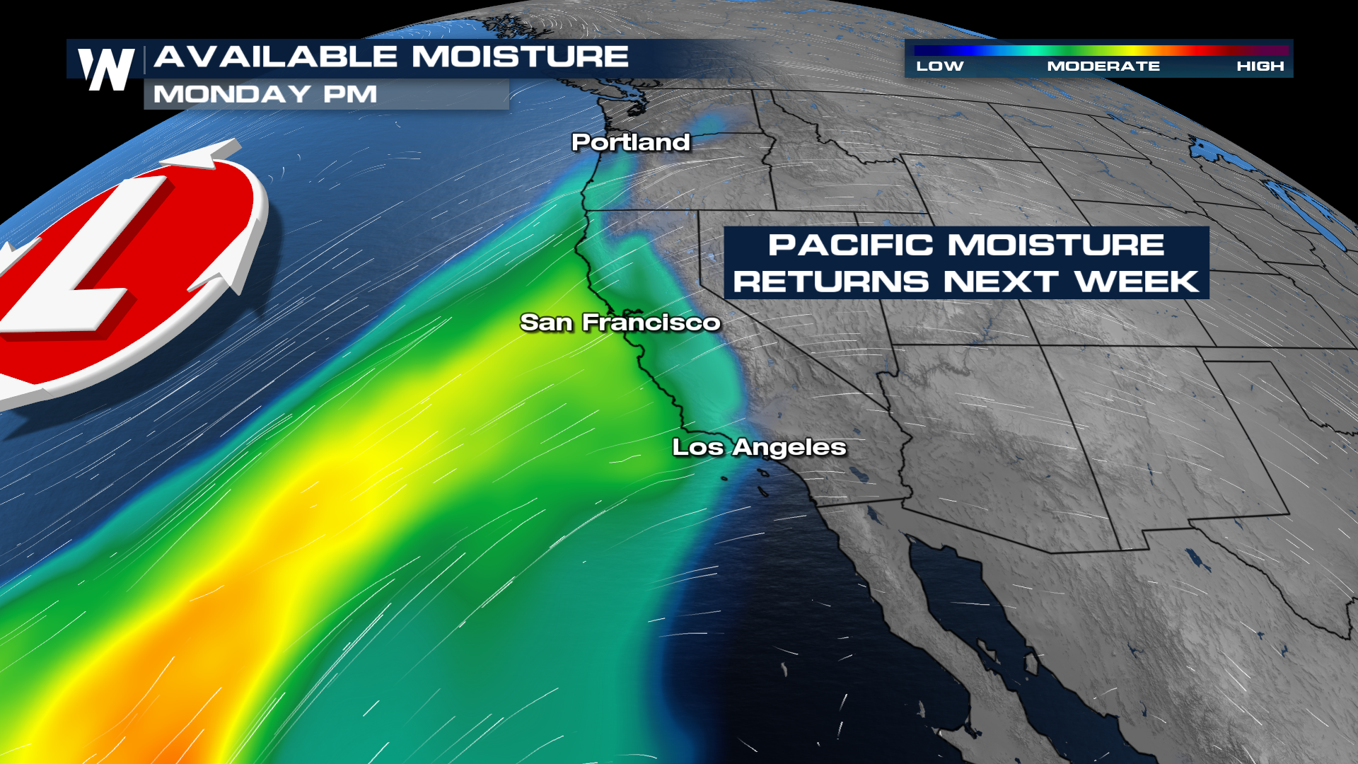
However, the quiet weather will not last long. Another Gulf of Alaska system is forecast to move into the Pacific Northwest on Sunday, bringing renewed moisture and unsettled conditions back into Southern California. While most models still vary on timing and coverage, current projections show a 30–40% chance of rain Sunday through Tuesday. At this point, the system does not appear particularly moisture-rich, and rainfall amounts look relatively light. 

All Weather News
More
Wildfire Danger: Extreme Conditions

Wildfire Danger: Extreme Conditions

Fire outlooks have been issued across the Fro

18 Feb 2026 2:30 PM
Stormy Pattern Continues This Week with More Rain, Mountain Snow Ahead for California

Stormy Pattern Continues This Week with More Rain, Mountain Snow Ahead for California

CALIFORNIA - The state of California has been

18 Feb 2026 11:40 AM
Weirdly Warm February on the Plains

Weirdly Warm February on the Plains

More record high temperatures were broken acr

18 Feb 2026 11:20 AM
Severe Storms Target the Midwest, Ohio Valley on Thursday

Severe Storms Target the Midwest, Ohio Valley on Thursday

While the Midwest has finally seen a break fr

18 Feb 2026 11:15 AM
Rounds of Snow Return to the Rockies

Rounds of Snow Return to the Rockies

ROCKIES - Widespread winter alerts remain in

18 Feb 2026 3:00 AM
Severe Storms Target the South Sunday

Severe Storms Target the South Sunday

Storms flew through Texas, Louisiana, and Mis

15 Feb 2026 11:05 PM
Lingering Snow in the Northeast

Lingering Snow in the Northeast

NORTHEAST - As this next clipper system cont

12 Feb 2026 8:05 AM